Tri-Service
The Satellites That 'Prevented World War III'

Google Earth has been surpassed, and it was done so in the 1970s.
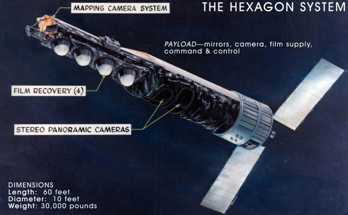
That's according to Phil Pressel, a high-level US engineer during the Cold War, who told CNN's 'Declassified' that the technology in question, a US spy satellite known as 'Hexagon', helped avert war with Russia.
Pressel worked for Perkin-Elmer, which designed and built cameras for the satellite.
Referred to as 'Keyhole-9' or 'Big Bird' within intelligence circles, the program ran from 1971 to 1986 and saw 20 satellites the size of an American school bus sent into space.
They were able to capture images in enough detail to see individual objects as small as two-feet wide, compared to three-feet wide for Google Earth's colour images today.
Pressel says that this level of technical sophistication - very advanced for the time - was extremely important:
"I honestly think that the Hexagon program was responsible for preventing World War III".
The pictures taken by Hexagon satellites enabled the US to ascertain that the USSR was not breaking arms control treaties because analysts were able to count individual missiles, aircraft, tanks, and troops.
Google Earth does possess one technological advantage over Hexagon though: Images are sent digitally.
Hexagon dropped hard copies of its images into 'buckets' that were then parachuted into Hawaii, leading to a dramatic search-and-rescue mission when one of them accidentally sank after re-entry, lest it fall into enemy hands.

