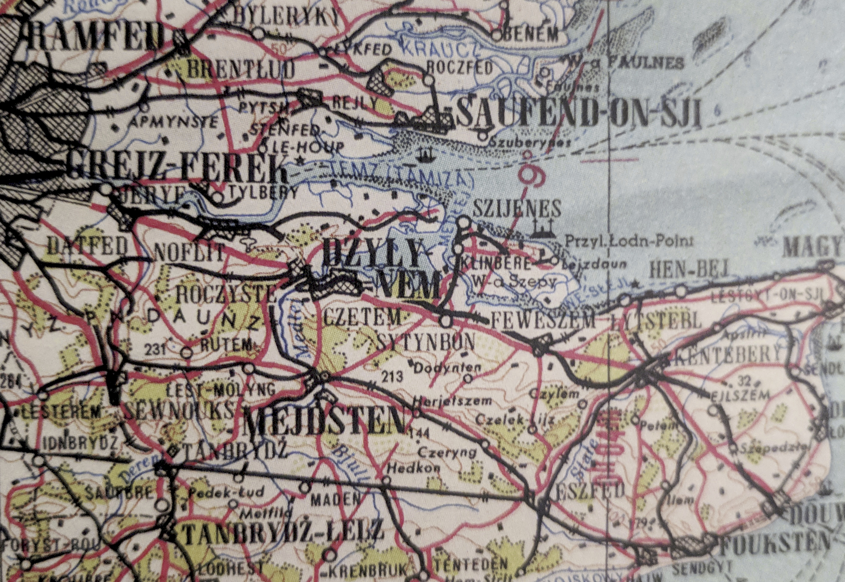
Soviet Cold War Maps Reveal Plans For Occupied Britain
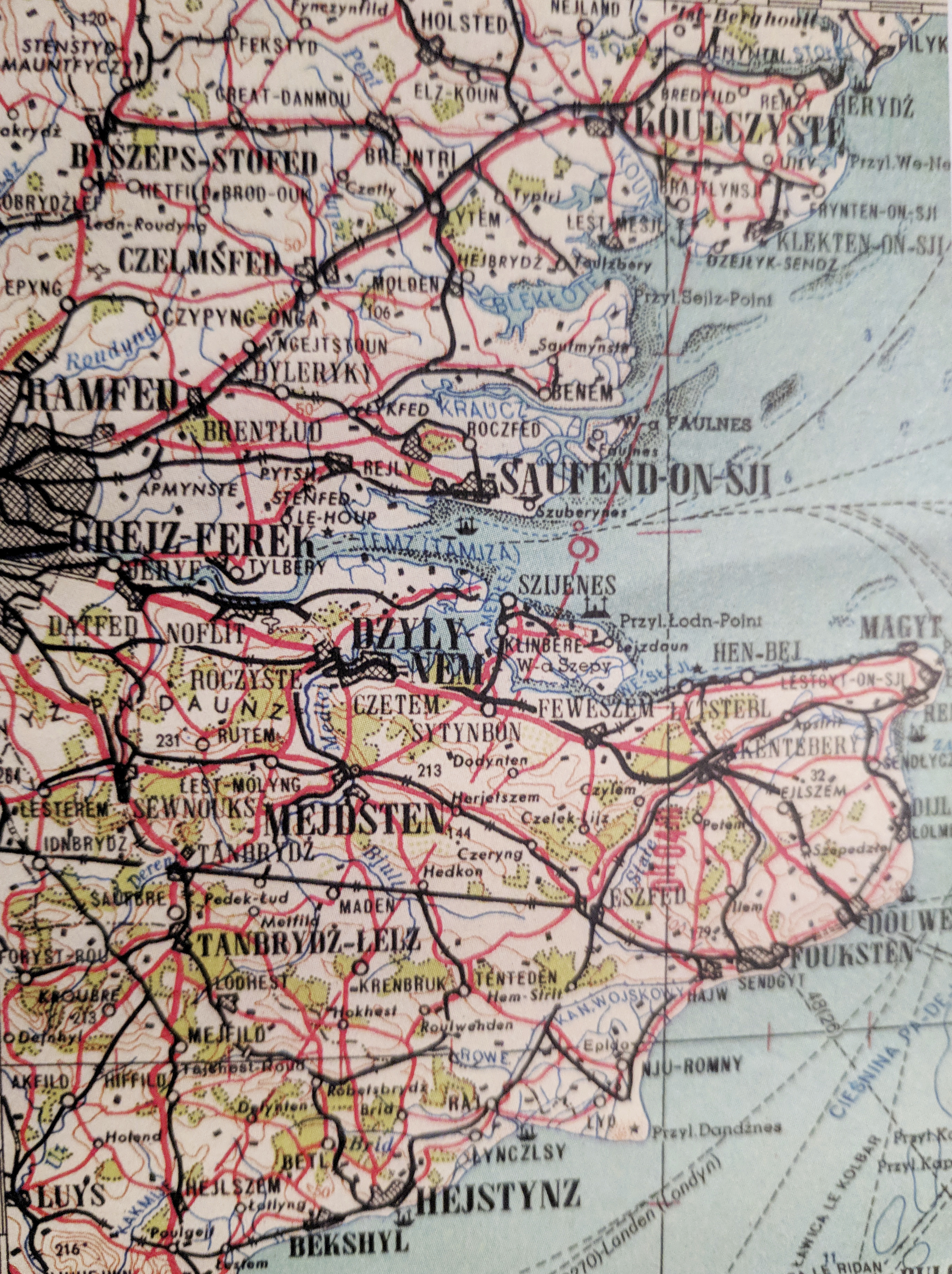
A Cold War map listing English place names with phonetic spellings would have been used by Warsaw Pact troops if they had invaded and occupied Britain.
The guide is from the Soviet Army's Red Atlas and uses Polish phonetic spellings to show how to pronounce names of places in Essex and Kent.
The map transforms Maidstone into 'Mejdsten', Romford becomes 'Ramfed' and Southend-On-Sea is 'Saufend-On-Sji'.
It would have been used by troops from the Soviet Union and their allies, including Albania, Poland, Romania, Hungary, East Germany, Czechoslovakia, and Bulgaria, had they invaded and occupied the UK's shores.
During the Cold War, the Soviet military mapped the entire world, producing extremely precise maps.
Spies from the USSR noted down details that would be impossible to find out without being on the ground, such as the type of buildings and factories, the width of roads and the load-bearing capacity of bridges.
They can be found in a book about Soviet military maps, called The Red Atlas by John Davies & Alexander J Ken, published by The University of Chicago Press.
Former researcher at The Economist, Alex White, tweeted an image of the map and the post has received more than 6,000 likes.
Scottish MP Peter Grant commented on the tweet, saying: "No sillier than English language maps of Poland."

Alex said that the book is "excellent for maps geeks."
Cover picture courtesy of SWNS.
Related topics
Join Our Newsletter